
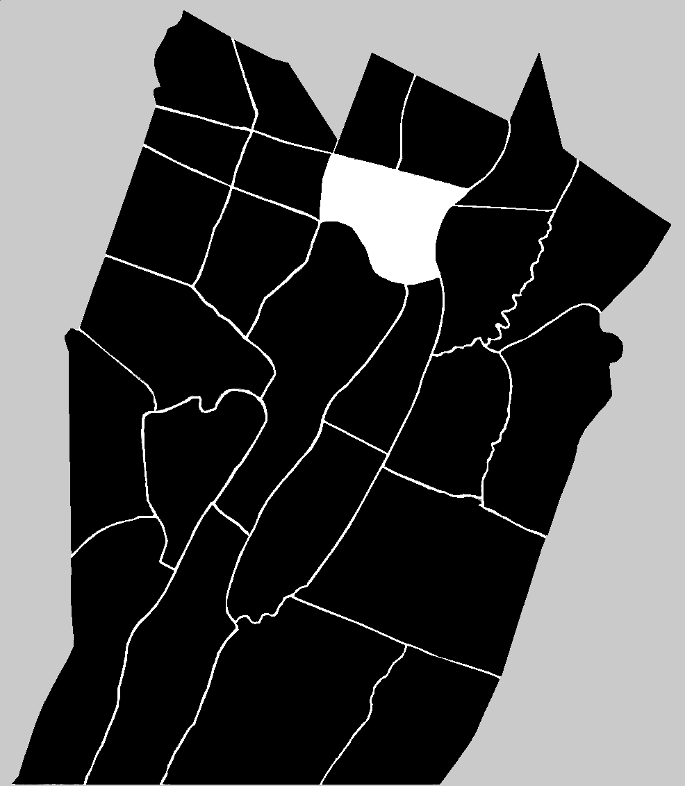
![]() Bedford and Barre Townships had been formed within Cumberland County in 1767. In 1771, when Bedford County was erected out of Cumberland, Bedford and Barre retained their names and physical boundaries. Four years later, coinciding with the beginnings of the American Revolutionary War in 1775, a new township was formed primarily out of the western arm of Barre, but also from the northernmost part of Bedford. The new township's name was Frankstown, bestowed in honor of Stephen Franks, and his trading post located to the east of present-day Hollidaysburg in Blair County. At the time it was formed, Frankstown Township encompassed the region between the Allegheny Mountain range on the west and the Tussey Mountain on the east. It stretched from the point where Evitts Mountain merges with Dunnings Mountain in the south to the southern end of Bald Eagle Mountain in the north ~ with the long Dunnings Mountain dividing it vertically. It retained those boundaries for ten years before the increasing population called for changes.
Bedford and Barre Townships had been formed within Cumberland County in 1767. In 1771, when Bedford County was erected out of Cumberland, Bedford and Barre retained their names and physical boundaries. Four years later, coinciding with the beginnings of the American Revolutionary War in 1775, a new township was formed primarily out of the western arm of Barre, but also from the northernmost part of Bedford. The new township's name was Frankstown, bestowed in honor of Stephen Franks, and his trading post located to the east of present-day Hollidaysburg in Blair County. At the time it was formed, Frankstown Township encompassed the region between the Allegheny Mountain range on the west and the Tussey Mountain on the east. It stretched from the point where Evitts Mountain merges with Dunnings Mountain in the south to the southern end of Bald Eagle Mountain in the north ~ with the long Dunnings Mountain dividing it vertically. It retained those boundaries for ten years before the increasing population called for changes.
![]() In 1785, the township of Frankstown was divided roughly in half by a north-south line that followed the summits of Lock Mountain and the east branch of Brush Mountain. The eastern part that was removed from Frankstown received the name: Woodberry Township. The new township could have, and perhaps should have been given the name: Morrisons Cove Township because the region it encompassed was primarily that cove.
In 1785, the township of Frankstown was divided roughly in half by a north-south line that followed the summits of Lock Mountain and the east branch of Brush Mountain. The eastern part that was removed from Frankstown received the name: Woodberry Township. The new township could have, and perhaps should have been given the name: Morrisons Cove Township because the region it encompassed was primarily that cove.
![]() In 1787, the county of Huntingdon was erected out of Bedford County by the plotting of a roughly southeast to northwest diagonal line. The eastern starting point of that dividing line began on the summit of the Tuscarora Mountain just a short distance to the east of Burnt Cabins and Fort Littleton. The line was plotted in the northwest direction through the gap defined by Dunnings Mountain and Short Mountain, once known as Frankstown Gap, but later McKee Gap. It then extended on westward through Blair Gap in the Allegheny Mountain. The erection of Huntingdon County divided Woodberry Township in two. That portion of Woodberry Township which lay north of the present-day towns of Martinsburg and Roaring Spring, Blair County would retain the name of Woodberry and would, in 1787, become part of Huntingdon County. The southern half also retained the name of Woodberry Township within Bedford County.
In 1787, the county of Huntingdon was erected out of Bedford County by the plotting of a roughly southeast to northwest diagonal line. The eastern starting point of that dividing line began on the summit of the Tuscarora Mountain just a short distance to the east of Burnt Cabins and Fort Littleton. The line was plotted in the northwest direction through the gap defined by Dunnings Mountain and Short Mountain, once known as Frankstown Gap, but later McKee Gap. It then extended on westward through Blair Gap in the Allegheny Mountain. The erection of Huntingdon County divided Woodberry Township in two. That portion of Woodberry Township which lay north of the present-day towns of Martinsburg and Roaring Spring, Blair County would retain the name of Woodberry and would, in 1787, become part of Huntingdon County. The southern half also retained the name of Woodberry Township within Bedford County.
![]() Thirteen years later, in 1798, Woodberry Township in Bedford County was divided by a north-south line which ran along the ridge of Dunnings Mountain. The portion which lay to the east retained the name of Woodberry. The western half of Woodberry Township was named Greenfield Township. Forty years would pass before any further changes were called for.
Thirteen years later, in 1798, Woodberry Township in Bedford County was divided by a north-south line which ran along the ridge of Dunnings Mountain. The portion which lay to the east retained the name of Woodberry. The western half of Woodberry Township was named Greenfield Township. Forty years would pass before any further changes were called for.
![]() In 1838, the township of Woodberry in Bedford County was divided with the southern half being called South Woodbury. Although the exact date is unknown, the change in spelling of the name Woodberry to Woodbury probably came about at that time.
In 1838, the township of Woodberry in Bedford County was divided with the southern half being called South Woodbury. Although the exact date is unknown, the change in spelling of the name Woodberry to Woodbury probably came about at that time.
![]() The effort to divide the township in two began in 1833.
The effort to divide the township in two began in 1833.
![]() At a Court of Quarter Sessions of the Peace in and for the said County of Bedford on the fourth Monday of January in the year of our Lord one thousand eight hundred and thirty three ~ Upon the petition of a number of citizens of the township of Woodberry in the County of Bedford Stating that on account of the extensive territory and dense population of said township they labour many and great disadvantages and inconveniences in attending the different elections, and in relation to the duties of the Supervisors ~ the roads in said township being very numerous ~ and praying that a division of said Township be made by running a line from Clappers Gap in Dunnings Mountain, beginning at the Greenfield Township line, thence in an Eastern direction so as to intersect the Hopewell Township line at Kunkles Gap in Tusseys Mountain, and that such order be made, as is prescribed by the act of Assembly in such case made and provided. Whereupon it is considered by the Court and ordered that John Bennett, John Piper, farmer, and John Piper Esquire be and they are hereby appointed Commissioners to view and examine the lines and boundery of the said new township prayed for and make report of their proceedings to the next Court of Quarter Sessions of the Peace according to Law. By the Court Job Mann Clerk
At a Court of Quarter Sessions of the Peace in and for the said County of Bedford on the fourth Monday of January in the year of our Lord one thousand eight hundred and thirty three ~ Upon the petition of a number of citizens of the township of Woodberry in the County of Bedford Stating that on account of the extensive territory and dense population of said township they labour many and great disadvantages and inconveniences in attending the different elections, and in relation to the duties of the Supervisors ~ the roads in said township being very numerous ~ and praying that a division of said Township be made by running a line from Clappers Gap in Dunnings Mountain, beginning at the Greenfield Township line, thence in an Eastern direction so as to intersect the Hopewell Township line at Kunkles Gap in Tusseys Mountain, and that such order be made, as is prescribed by the act of Assembly in such case made and provided. Whereupon it is considered by the Court and ordered that John Bennett, John Piper, farmer, and John Piper Esquire be and they are hereby appointed Commissioners to view and examine the lines and boundery of the said new township prayed for and make report of their proceedings to the next Court of Quarter Sessions of the Peace according to Law. By the Court Job Mann Clerk
![]() The commissioners returned their report on 13 April, but the Court returned it to them on the 15th with the request that they supply a plot or draft of the lines. Apparently the requested draft was returned during the summer. During the August Session, the order was continued. In fact it was continued again during the November session and then during the January Session of 1834. It was not considered again until the January Session of 1837, at which the Court again continued it. It was continued during the September Session of 1837 and again during the January Session of 1838. During the session of 17 April 1838, the report was once again read. On 30 August 1838 the report was "read & confirmed & the township to be divided according to the draft into two distinct Townships the one to be called North Woodberry & the other to be called South Woodberry Towp."
The commissioners returned their report on 13 April, but the Court returned it to them on the 15th with the request that they supply a plot or draft of the lines. Apparently the requested draft was returned during the summer. During the August Session, the order was continued. In fact it was continued again during the November session and then during the January Session of 1834. It was not considered again until the January Session of 1837, at which the Court again continued it. It was continued during the September Session of 1837 and again during the January Session of 1838. During the session of 17 April 1838, the report was once again read. On 30 August 1838 the report was "read & confirmed & the township to be divided according to the draft into two distinct Townships the one to be called North Woodberry & the other to be called South Woodberry Towp."