

![]() Lieutenant James Baker was one of a group of surveyors who were engaged by Colonel Henry Bouquet to survey the course of the road for the Forbes Expedition to Fort Duquesne in 1758. In addition to Baker was Captain Asher Clayton and Captain Edward Ward. All three submitted individual reports, and all three mentioned the 'Old Town.' Lieutenant Baker, in his report of July 1758 noted:
Lieutenant James Baker was one of a group of surveyors who were engaged by Colonel Henry Bouquet to survey the course of the road for the Forbes Expedition to Fort Duquesne in 1758. In addition to Baker was Captain Asher Clayton and Captain Edward Ward. All three submitted individual reports, and all three mentioned the 'Old Town.' Lieutenant Baker, in his report of July 1758 noted:
![]() July 8th 1758 Set out from Camp near Reas Town about 6 O Clock in the Afternoon with Capts Ward & Clayton Lieuts Campbell, Baker, Hay, & craighead and One Hundred private. 2 Miles from Camp we Crossed Juniatta where we came into Hogs Road one Mile along the sd Road encamped at old Town. July 9th contd our March from old Town to the Shawnes Cabins . . .
July 8th 1758 Set out from Camp near Reas Town about 6 O Clock in the Afternoon with Capts Ward & Clayton Lieuts Campbell, Baker, Hay, & craighead and One Hundred private. 2 Miles from Camp we Crossed Juniatta where we came into Hogs Road one Mile along the sd Road encamped at old Town. July 9th contd our March from old Town to the Shawnes Cabins . . .
![]() The 'Hogs Road' that Baker mentioned was simply a mistake in the name. He meant to say Burd's Road, and later in the report he correctly called it 'Bird's Road.' The 'Camp near Reas Town' would have referred to the troop encampment just to the west of the newly constructed fortified structure that would eventually be named 'Fort Bedford'. At a point two miles west of the encampment, the survey party would indeed have encountered and crossed over the Raystown Branch of the Juniata River. That was in the vicinity of the present-day village of Wolfsburg. One mile 'along sd Road'would have brought the group to a point just adjacent to the east of the property currently occupied by the Bedford County Historical Society.
The 'Hogs Road' that Baker mentioned was simply a mistake in the name. He meant to say Burd's Road, and later in the report he correctly called it 'Bird's Road.' The 'Camp near Reas Town' would have referred to the troop encampment just to the west of the newly constructed fortified structure that would eventually be named 'Fort Bedford'. At a point two miles west of the encampment, the survey party would indeed have encountered and crossed over the Raystown Branch of the Juniata River. That was in the vicinity of the present-day village of Wolfsburg. One mile 'along sd Road'would have brought the group to a point just adjacent to the east of the property currently occupied by the Bedford County Historical Society.
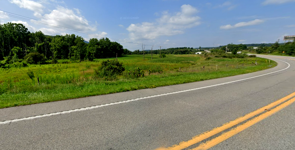
![]() The location of the abandoned Amerindian site was about a half mile to the west of the town of Wolfsburg. At the present day, the site of the abandoned Amerindian village is occupied by a field.
The location of the abandoned Amerindian site was about a half mile to the west of the town of Wolfsburg. At the present day, the site of the abandoned Amerindian village is occupied by a field.
